1
of
2
Loading...
SKU · 740399009962
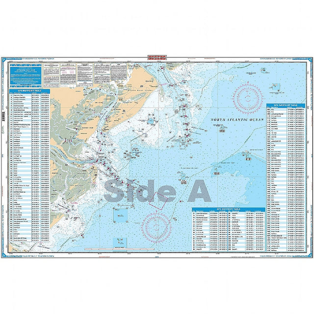
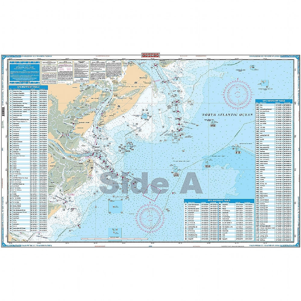
Waterproof Charts 138F Lower St. Johns River Fishing Lake Fishing
Offshore coverage from the Charleston Light south to 30 miles south of Jacksonville, Florida and offshore approximately 70 miles. Includes the eight "Navy Towers”. Large Print and Large Print Place Names make this chart very easy to read.
Free Shipping $99+
Captain-Guided Support
Tournament Tested
Best Price Match
1 in stock — Almost gone!
Free shipping over $99
4 payments of $7.48
with Shop Pay
Ready for pickup in 4 business hrs
4301 N Federal Hwy, Pompano Beach FL · Get directions
Select Local pickup at checkout

Product Highlights
Waterproof Charts 138F Lower St. Johns River Fishing Lake Fishing
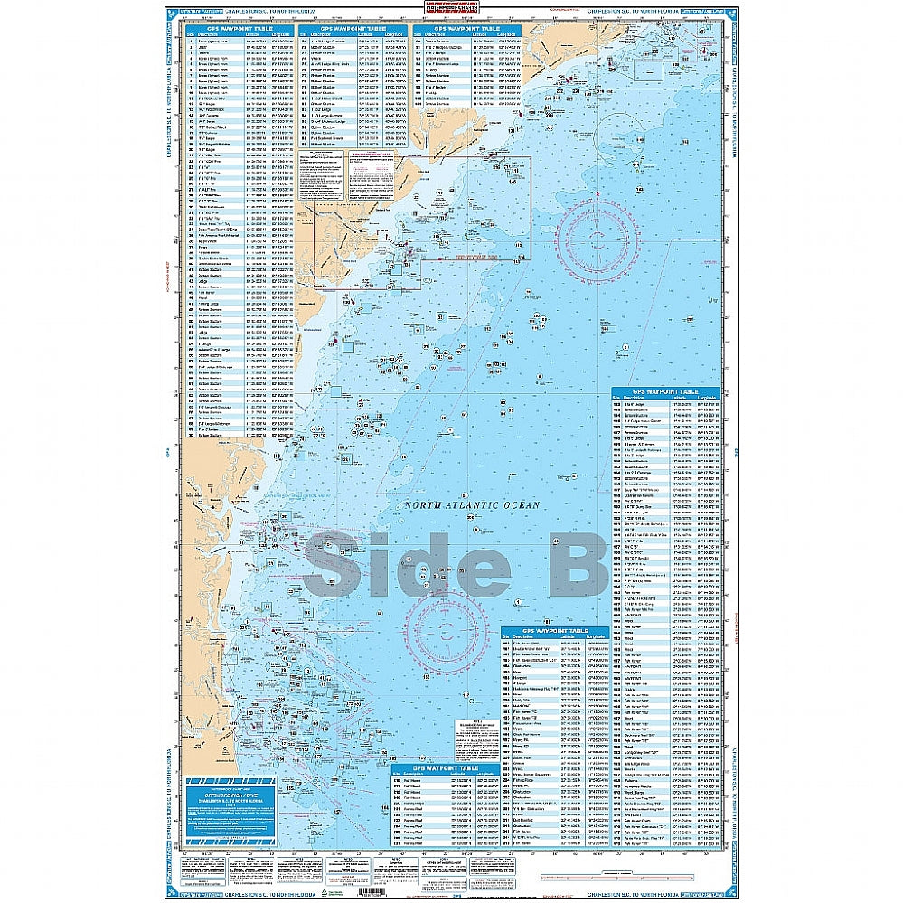
Offshore coverage from the Charleston Light south to 30 miles south of Jacksonville, Florida and offshore approximately 70 miles. Includes the eight "Navy Towers”. Large Print and Large Print Place Names make this chart very easy to read. The reverse side covers the coastal area off of Hilton Head and Savannah out to the Hunting Island Reef (60′ Depth). A total of 390 GPS coordinates are plotted for reefs and wrecks, artificial reefs, hardbottom areas, lights, buoys, and fishing and diving areas.