1
of
3
Loading...
SKU · 740399013860
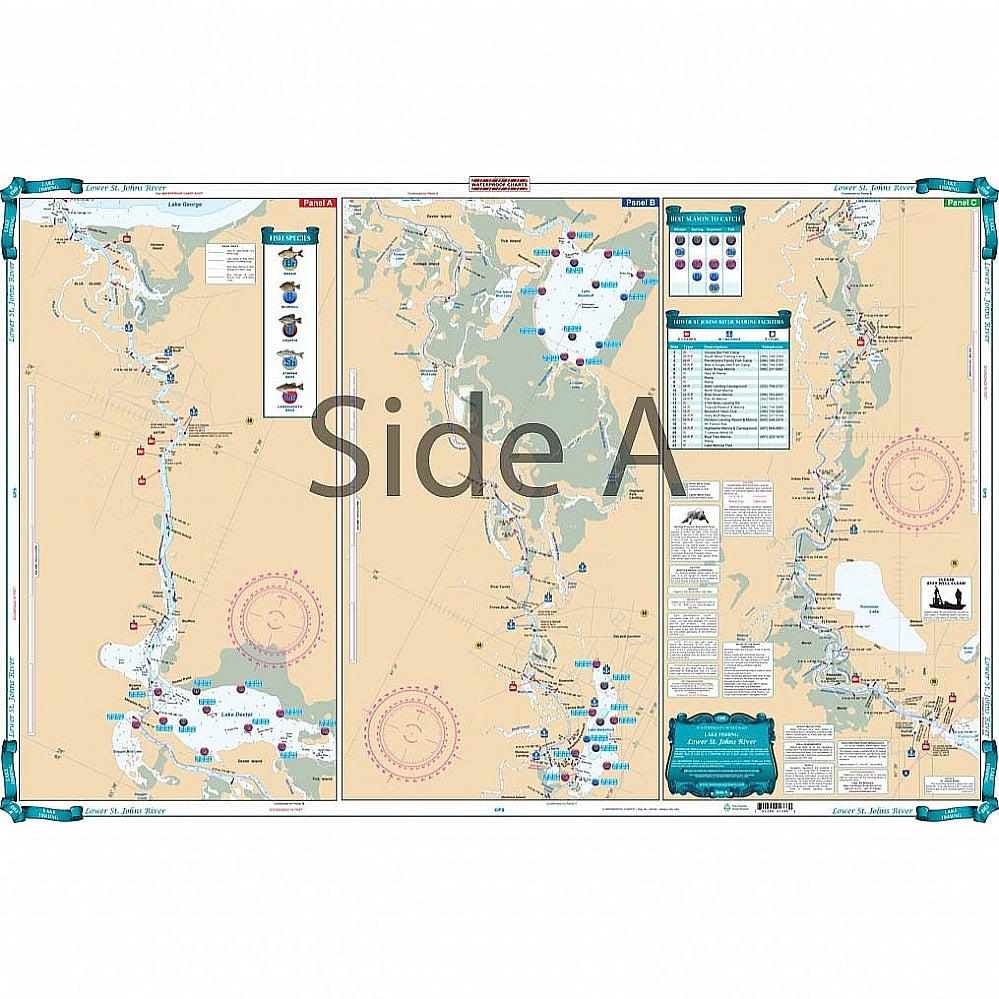
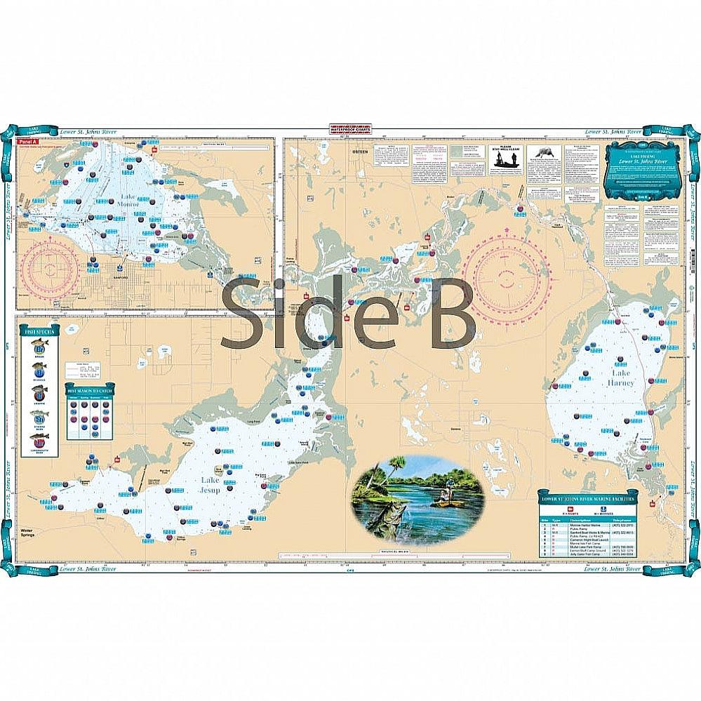
Waterproof Charts 138F Lower St. Johns River Fishing Lake Fishing
Covering the area from Lake Harney to the bottom of Lake George. This chart details all the major grass flats, marshes, and kayak trails.
Free Shipping $99+
Captain-Guided Support
Tournament Tested
Best Price Match
1 in stock — Almost gone!
Free shipping over $99
4 payments of $7.48
with Shop Pay
Ready for pickup in 4 business hrs
4301 N Federal Hwy, Pompano Beach FL · Get directions
Select Local pickup at checkout

Product Highlights
Waterproof Charts 138F Lower St. Johns River Fishing Lake Fishing
Covering the area from Lake Harney to the bottom of Lake George. This chart details all the major grass flats, marshes, and kayak trails. The chart pinpoints dozens of specific areas for the major species caught and best seasons to catch: Bluegill, Largemouth Bass, Channel Catfish, Crappie, Bream, and Striped Bass. There is a handy marine facilities guide included, with locations of different boat ramps, all shown on the chart. Grab this vibrantly colored St Johns River fishing chart and start catching more fish! This navigation map covers the area from Lake Harney to the bottom of Lake George. This marine map details all the major grass flats, marshes, and kayak trails. The chart pinpoints dozens of specific areas for the major species caught and best seasons to catch: Bluegill, Largemouth Bass, Channel Catfish, Crappie, Bream, and Striped Bass. There is a handy marine facilities guide included, with locations of different boat ramps, all shown on the navigation chart.
